

 Online Store
Blog details
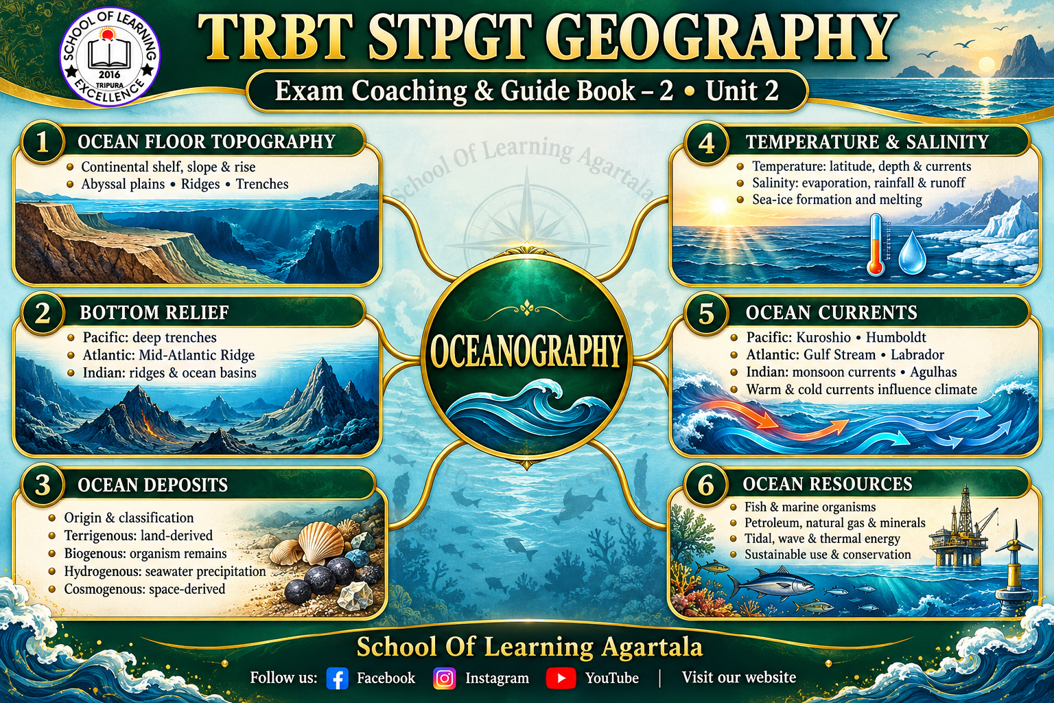 RBT STPGT Geography Climatology Coaching & Guide Book 3 | School Of Learning Agartala
TRBT STPGT Geography: Climatology Coaching and Guide Book 3
Climatology helps us understand why temperatures vary across Earth, how winds develop, why rainfall occurs and what controls the Indian monsoon. For students preparing for TRBT STPGT Geography, Unit 3 connects atmospheric processes with the weather and climatic conditions experienced across different regions.
School Of Learning Agartala’s Geography Guide Book 3: Climatology covers these topics for organised study and revision. Alongside offline or online coaching, students can develop their understanding of the atmosphere, heat balance, pressure belts, cyclones, precipitation and world climatic regions.
Composition and Structure of the Atmosphere
The atmosphere is the envelope of gases surrounding Earth. Dry air consists mainly of nitrogen and oxygen, with smaller amounts of argon, carbon dioxide and other gases. Water vapour varies considerably across locations and plays an essential role in cloud formation, precipitation and heat transfer.
The atmosphere is divided into layers according to its temperature structure: the troposphere, stratosphere, mesosphere, thermosphere and exosphere. Most weather occurs in the troposphere, while the stratosphere contains the major concentration of atmospheric ozone, which absorbs ultraviolet radiation.
For STPGT Geography preparation, students should connect each atmospheric layer with its temperature trend and characteristic features. Understanding the boundaries between layers is also useful when studying atmospheric structure.
Elements of Weather and Climate
Weather describes atmospheric conditions at a particular place and time. Climate describes the long-term patterns and variability of those conditions.
The main elements include temperature, atmospheric pressure, wind, humidity, cloud cover and precipitation. These elements interact: uneven heating creates pressure differences, pressure differences influence winds, and winds transport heat and moisture.
For example, a rainy afternoon represents a weather condition. A region’s recurring pattern of wet summers and dry winters forms part of its climate. Recognising this distinction provides a foundation for the rest of Climatology.
Insolation, Heat Budget and Temperature Inversion
Insolation is incoming solar radiation received by Earth. Its distribution depends on factors such as the angle of the Sun’s rays, length of daylight and atmospheric transparency.
Earth absorbs part of this energy and returns energy to space through reflected sunlight and outgoing longwave radiation. The heat budget explains these exchanges. Differences in heating between regions help drive atmospheric and oceanic circulation.
Temperature distribution depends on latitude, altitude, distance from the sea, ocean currents, prevailing winds and local relief. Coastal locations often experience smaller temperature ranges than inland locations because water heats and cools more slowly than land.
Normally, temperature decreases with height through much of the troposphere. A temperature inversion occurs when temperature increases with height within a layer. Clear, calm nights can favour surface cooling and inversion formation. Inversions can suppress vertical mixing and allow pollutants to accumulate near the ground.
Pressure Belts and Wind Systems
Atmospheric pressure varies across Earth because of thermal and dynamic processes. The major pressure belts include the equatorial low, subtropical highs, subpolar lows and polar highs.
These pressure patterns are associated with the trade winds, westerlies and polar easterlies. Their distribution is modified by seasonal changes, continents, oceans and relief.
Students should understand how pressure-gradient force, the Coriolis effect and friction influence wind movement. The Hadley, Ferrel and Polar circulation cells provide a useful framework for studying global atmospheric circulation.
The seasonal movement of pressure belts and the Intertropical Convergence Zone also helps explain changes in rainfall and wind direction, including aspects of monsoon circulation.
Tropical Cyclones, Extratropical Cyclones and Anticyclones
Atmospheric disturbances produce important changes in weather. Comparing their formation, structure and effects is a central part of STPGT Climatology preparation.
Tropical cyclones generally develop over warm tropical oceans when sufficient moisture, favourable atmospheric conditions and adequate rotation are present. They can bring strong winds, intense rainfall and storm surges. A well-developed system may contain an eye surrounded by an eyewall of powerful thunderstorms.
Extratropical cyclones commonly develop in middle latitudes and are associated with contrasts between air masses. Fronts play an important role in their structure and weather. Their rainfall and temperature patterns differ from those of tropical cyclones.
Anticyclones are high-pressure systems generally associated with descending air. They often favour stable conditions, although fog, low cloud or cold conditions may occur depending on the season and location.
Students should compare these systems by pressure, air movement, fronts, geographical occurrence and associated weather.
Indian Monsoon: Origin, Characteristics and Effects
The Indian monsoon is a seasonal circulation system involving major changes in winds and rainfall. Its development reflects several interacting influences, including differential heating of land and sea, movement of the tropical convergence zone, upper-air circulation and surrounding ocean conditions.
The southwest monsoon supplies much of India’s annual rainfall. The northeast monsoon is especially important for rainfall in parts of southeastern peninsular India.
Important characteristics include the onset, seasonal advance, active and break phases, withdrawal and uneven distribution of rainfall. Monsoon conditions influence agriculture, water availability, reservoirs and everyday economic activity.
For examination preparation, students should also understand how El Niño, La Niña and the Indian Ocean Dipole can influence monsoon variability. These influences interact with other factors and do not produce identical outcomes every year.
Precipitation: Processes, Forms and Types of Rainfall
Precipitation occurs when water droplets or ice particles grow large enough to fall from clouds. Cloud formation alone does not necessarily result in precipitation.
Two important growth mechanisms are the collision and coalescence of droplets and the ice-crystal process in mixed-phase clouds. Forms of precipitation include rain, snow, sleet and hail.
Rainfall is commonly classified by the mechanism lifting the air:
- Convectional rainfall: Heated air rises, cools and condenses.
- Orographic rainfall: Moist air is forced upward over elevated terrain.
- Cyclonic rainfall: Air rises through convergence or along fronts associated with low-pressure systems.
The rain-shadow effect illustrates the influence of relief. A mountain’s windward side may receive substantial rainfall, while descending air on the leeward side produces relatively drier conditions.
Characteristics of Major Climatic Regions
Comparing climatic regions helps students connect temperature, rainfall, seasonality and geographical location.
| Climatic region | Main characteristics |
|---|---|
| Equatorial | High temperatures throughout the year, abundant rainfall and a small annual temperature range. |
| Monsoon | Strong seasonal rainfall contrasts associated with changing circulation. |
| Mediterranean | Generally hot or warm, dry summers and mild, wetter winters. |
| Desert | Very low precipitation, sparse vegetation and substantial moisture deficit. |
| Steppe | Semi-arid conditions, with more precipitation than deserts and widespread grassland environments. |
| Tundra | Long, cold winters and a short, cool growing season; trees are generally absent. |
| Highland | Conditions vary with altitude, slope direction and exposure; temperature generally decreases with elevation. |
Students should study the world distribution of these regions and practise identifying them from temperature and rainfall descriptions. Climatic graphs are particularly helpful for recognising seasonal patterns.
How to Prepare Climatology for TRBT STPGT Geography
Climatology becomes easier when topics are studied as a connected sequence: solar heating affects temperature, temperature differences influence pressure, pressure differences drive winds, and moving air transports moisture.
For effective revision:
- Learn key definitions with a clear example.
- Draw atmospheric layers, pressure belts and circulation cells.
- Compare tropical cyclones, extratropical cyclones and anticyclones.
- Connect monsoon mechanisms with seasonal rainfall patterns.
- Practise identifying climatic regions from their characteristics.
- Solve topic-wise MCQs and review the explanation behind each answer.
Use Geography Guide Book 3: Climatology to organise these topics and revisit concepts that require further practice.
TRBT STPGT Geography Coaching at School Of Learning Agartala
Students looking for TRBT STPGT Geography coaching in Agartala can contact School Of Learning Agartala for offline and online learning options and guide book details.
A clear understanding of atmospheric processes supports preparation across Climatology and related areas of Geography. Studying each concept alongside examples, illustrations and questions helps turn individual facts into connected knowledge.
Follow School Of Learning Agartala on Facebook, Instagram and YouTube. Visit our website for course information, study materials and academic updates.
Leave a Comments
Recent Post
-

-
 Tripura TET-II Exam 2026–27 18-10-2026
-
 Tripura TET-II Exam Science 2026–27 18-10-2026
-
-
Gallery
-
No image available.